On February 8, 2021 Bradford Council published for consultation “Bradford District Local Plan – Preferred Options (Regulation 18) and Call for Sites”. The document, which will be paraphrased in a new page, and comments will be made on the sites shown in the 2016 document.
The consultation is open from 9am on Monday 8th February through to 23:59hrs on Wednesday 24 March 2021. See https://content.govdelivery.com/accounts/UKBMD/bulletins/2c011e3
The new proposals for Thornton can be seen at Thornton Local Area Plan
* Following a change in Government policy the numbers of new dwellings to be built throughout the Bradford Metropolitan District up to 2030 has been reduced.
Here are listed the areas of land in Thornton which might be built on as a result of Bradford Council’s proposals to have built in Thornton 700 dwellings between 2013 and 2030, to meet what it believes will be housing demand during that period. The consultation is not on the number of dwellings (houses / flats), but where they should be, so comments about not enough school places, or problems getting an appointment at the doctors will be ignored. The closing date for comments was July 19th, 2016.
There was a Public Enquiry in March 2015 concerning the number of houses for Thornton. One of our former councillors attended and spoke against the Council’s plans, The Government-appointed planning inspector who headed that Enquiry has now approved the Council’s plans (Sept 6, 2016). In the meantime Bradford Council is consulting on potential sites. It has identified sites, in Thornton and the edge of Keelham, which if they were all developed would be sufficient for about 1400 dwellings.
NOTE: On 11 October 2016 it was reported in the Telegraph and Argus that a Government Planning Minister had pressed pause on Bradford Council’s Core Strategy Plan after an MP argued against it on the grounds of the damage it will do to the green belt, particularly in Wharfedale. After re-consideration of the evidence and the Inspector’s findings the Minister of State for Local Government allowed the Council to proceed to adopt the Core Strategy as part of the Local Plan. The Core Strategy was adopted by the Council on 18 July, 2017. For details of the latest position see the Council’s “Plan-It” newsletters. The latest (July 2017) can be opened or downloaded from this page.
When the Council has considered all the comments they’ll bring out a Preliminary Draft Plan, on which they’ll seek further comments. This was planned for the summer of 2017, but has been delayed.
In preparing their Final plan of Land Allocations there are several stages to go through. these are:
- Issues and Options Consultation – carried out to ensure that all current reasonable options are covered. Following consultation evidence will be gathered, technical appraisals of sites carried out, and alternatives compared
- Preliminary Draft Plan – the Council will publish and consult on its preliminary ideas on a settlement by settlement basis
- Publication Draft Plan – The Council will publish a full draft plan and undertake further consultation
- Submission Stage – the Council submits its Plan to the Planning Inspectorate for examination
- Examination In Public – A Planning Inspector will be appointed by the Government to scrutinise the plan, listen to alternative viewpoints in a series of public hearings, and determine whether the plan is sound
- Adoption of the Plan – This will occur after receipt of the Inspectors report
This current consultation is the first stage – issues and options consultation. but one when we can influence which sites are chosen.
Bradford Council consulted on its plans up to 19 July 2016. Further details of the proposals for Thornton can be seen at penninetownssubareabackgroundpaper especially pages 26 to 30.
We are unable to reproduce Bradford Council’s maps based on the Ordnance Survey maps because of copyright restrictions. We believe the maps below (Word files), are free of copyright. They are taken from the Pennine Towns Background Paper, page 29, which does not indicate they are subject to copyright restrictions. We also provide photographs of some sites.
Maps just of the ‘Pennine Towns’ which includes Thornton can be seen at penninetownsmapbook
Once a site has been reserved for housing the principle of building on that land has been estasblished, so when a planning application is submitted by developers for that land, representations against building can only be on layout and design. Bradford Council is also consulting on Green spaces in Thornton – scroll down to information about Green spaces at the end of the list of potential housing sites.
Comments had to be made to Bradford Council by 5pm on July 19th, 2016.
Sites with planning permission and deliverable (according to Bradford Council) Totalling about 235 houses
- TH/001 (already built) Land south of Thornton Cemetery, comprising houses and flats on Thornton Road, Woodsley Fold, Kellet Drive and Rowlands Avenue. (122 dwellings)
- TH/002 Close Head. Land to the west of Thornton Cemetery. Has received planning permission in the past. Delays due to disagreement of one landowner, (Bradford Council) about the internal road, which comes off the cemetery access road, (the Cemetery entrance gates to be moved back so that 40 yards of the road could be used by both cemetery visitors and those accessing the new housing) Possible 48 dwellings Bradford Council has now received planning permission for 5 houses, accessed by a private driveway from Hill Top Road, for the field immediately above the existing 19th century terraced houses at Close Head. (Updated January 18, 2017)
- This site is no longer included in the Thornton Area Local Plan suggested sites, 2021. (Updated 8 March 2021)
- TH/004 Land off Sapgate Lane – the field below Oak Hall Park. Planning permission has already been granted for 17 dwellings, but has lapsed. It is likely however, as the principle of housing on this land has been established that a new application for building on this land would be granted. Planning permission was granted for 17 houses in September 2019. (Updated 30 September 2019)
- TH/011 Old Road. Building nearly finished including Old Road frontage, Allerton View, and Buffham Pastures. Planning permission granted for 64 dwellings.
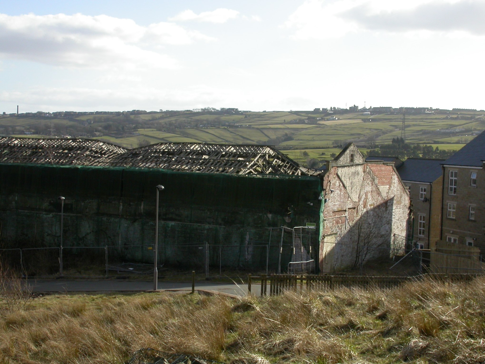
- TH/015 James Street The derelict mill building and adjoining land abutting West Lane. The land was sold by auction in June 2016. It had previous planning permission for 27 dwellings. This site is now being re-developed. (Updated 30 September 2019)
- TH/016 Sapgate Lane / Northcliffe Lane. Victoria Cottage and garden site. Possible 3 dwellings. ***This site is no longer included in the Thornton Area Local Plan suggested site (Updated 8 March 2021)
- TH/017 Valentine Court / Cliffe Lane. Land previously partly developed (roadways). Then not developed. Current planning permission for a few houses but Council believes 9 possible. Update: 2 separate planning applications were submitted in late July 2016, to put a total of 7 detached houses on this site with vehicle access to Valentine Court and Back Lane. The land is in 2 different ownerships. Planning applications numbers 16/05388/OUT and 16/06228/FUL Both planning applications have been granted planning permission (Updated January 18, 2017)
Deliverable and developable sites suitable for residential development subject to obtaining planning permission (Bradford Council’s words)
- TH/003 Off Thornton Road, east of the cemetery. From Albion Mill field northwards to meet site TH/009, and eastwards behind Albion Place, then at a lower level, eastwards behind houses on Thornton Road to a point opposite the northern boundary of Thornton Bowling Green. Where there are no houses, the site comes down to Thornton Road. Possible 171 dwellings

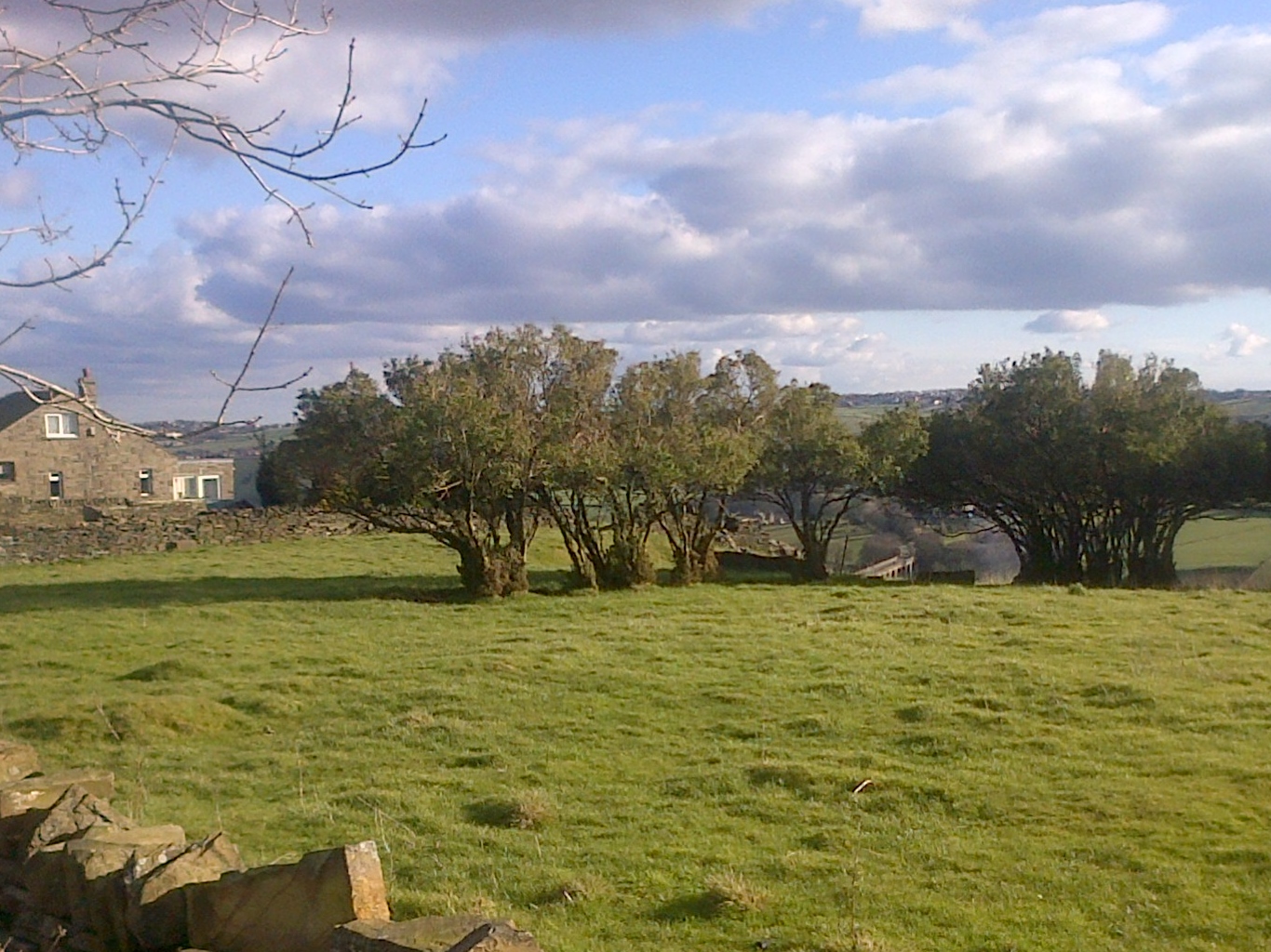
This photograph shows the field adjoining the footpath which goes up from Wensley Bank West to the Brontë Way The boundary wall shown is opposite the northern edge of the Bowling Green. The field on the left leading down to Thornton Road is part of TH/003. ** This site has been reduced in the 2021 Thornton Area Local Plan’s suggested sites (Updated 8 March 2021)
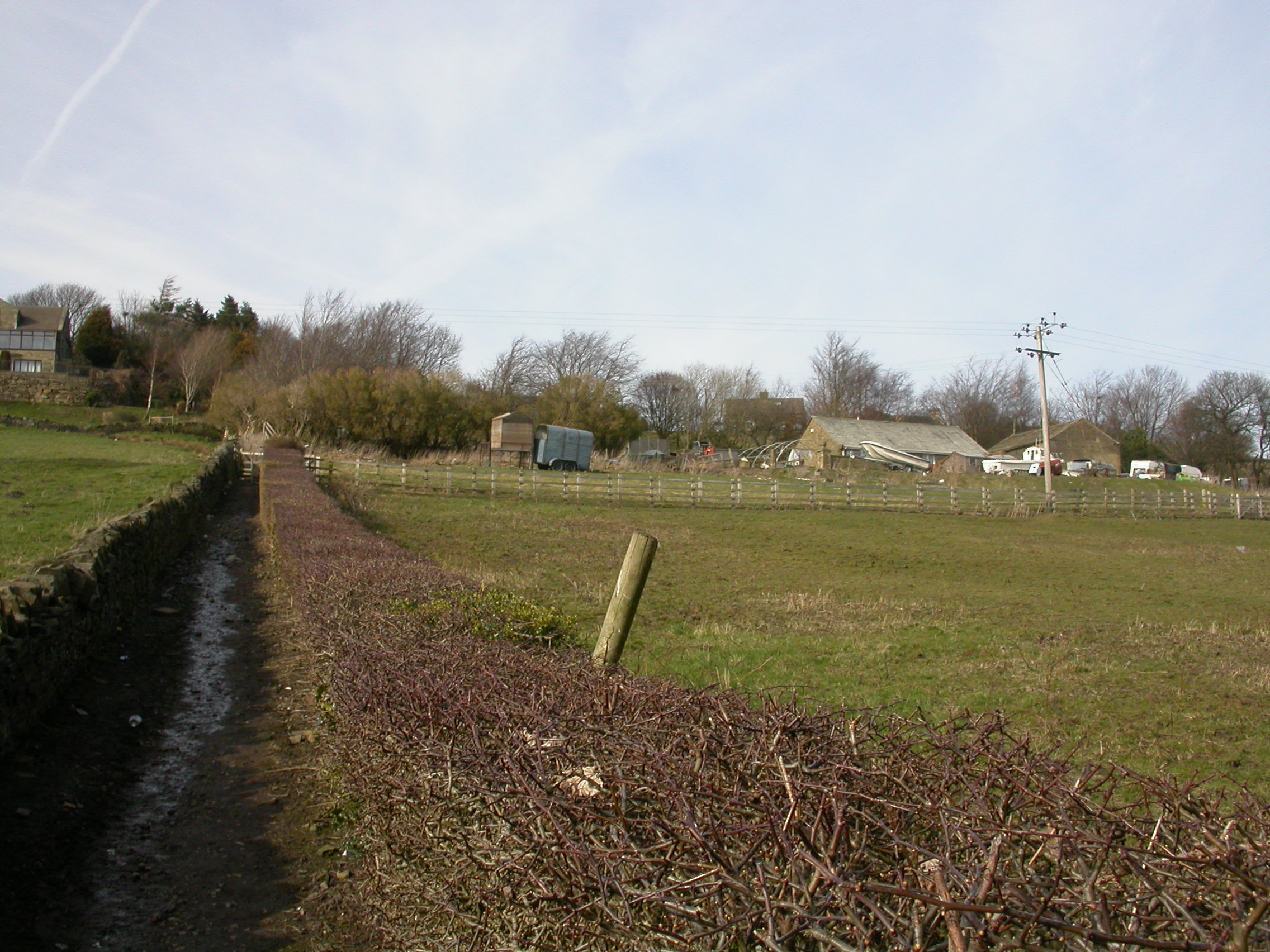
- TH/009 Hill Top Road. Land running southwards between and in front of existing dwellings from Hill Top Farm to in front of and south of 127 and 133 Hill Top Road. Possible 40.5 dwellings. The photo below shows the field which is on Hill Top Road frontage between numbers 89 Hill Top Road and 127 Hill Top Road.
The extent of this site is the whole of the field shown to its southern boudary wall. The extent to the south of numbers 127 to 133 would be an extension of that boundary wall. However because Site TH/003 extends in this area all the way up from Thornton Road from the former Albion Mill, potential housing would cover the whole area south of 127 to 133 down to Thornton Road. A portion of this land is currently designated as Greenspace. ** This site has been reduced in the 2021 Thornton Area Local Plan’s suggested sites (Updated 8 March 2021)
- TH/010 Hill Top Road Sloping land with springs, bought by Bradford Council for allotments, leading southwards at the back of properties on Moss Street, to the northern boundary of the allotments and the bowling green. Its western edge is the garden walls of 9-11 Hill Top Road, and the footpath leading up from Wensley Bank West. Possible 55 dwellings. ** This site has been reduced in the 2021 Thornton Area Local Plan’s suggested sites (Updated 8 March 2021)
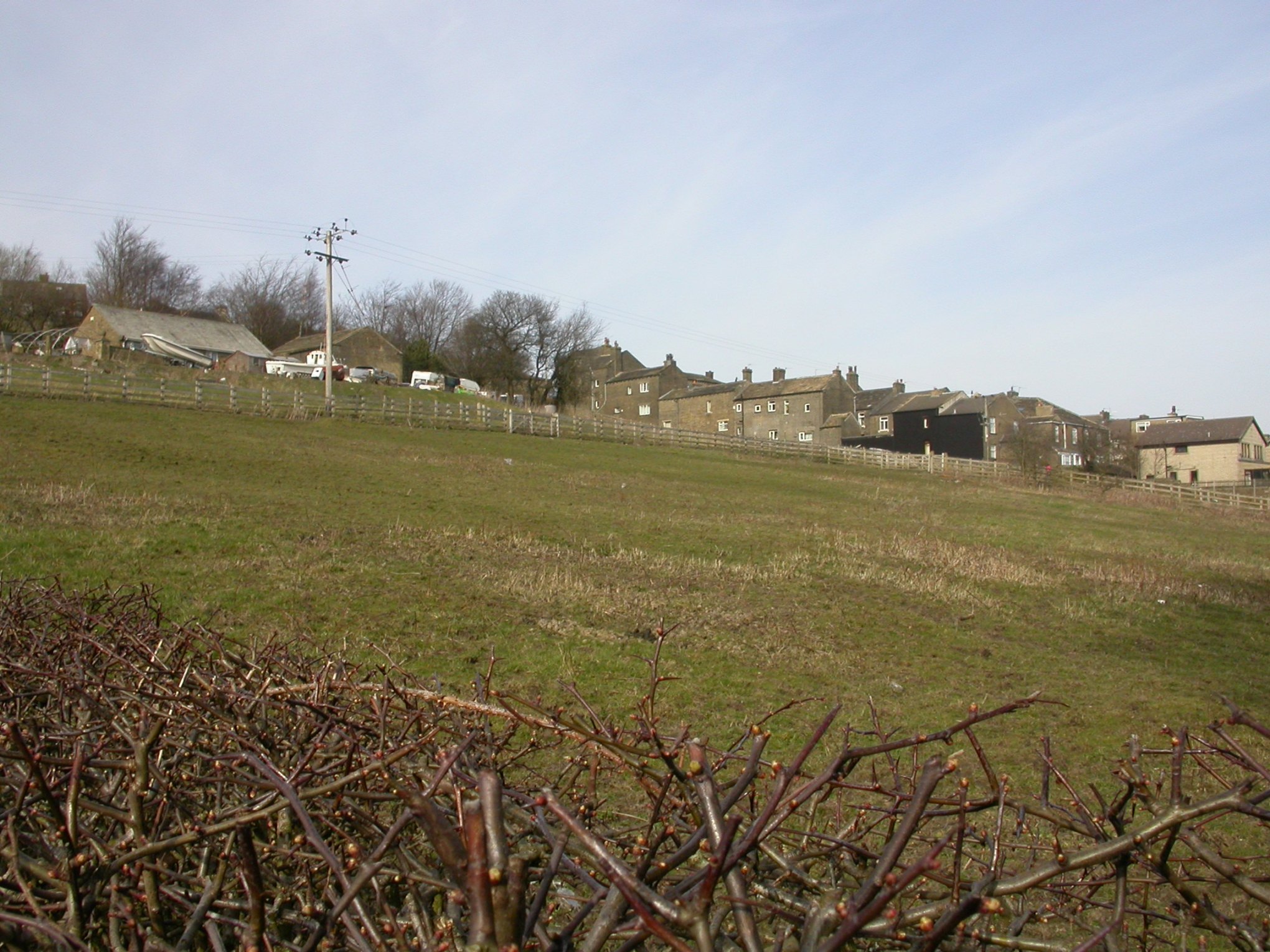
This is quite steep land, much steeper than the photo’ shows.
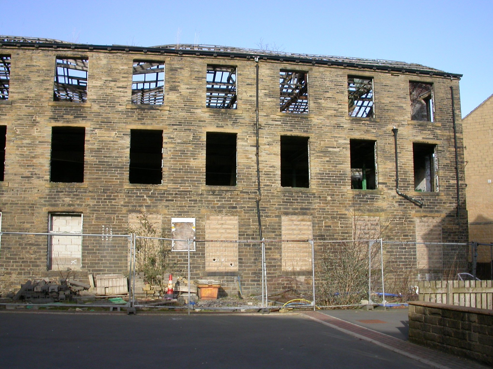
- TH/012 Thornton Road, Dole and Prospect Mills. At the time the Council last reported on this site the front, side, and centre blocks were standing. The centre and side blocks were demolished because they were deemed too dangerous, and the front block was demolished after a fire. The remaining 2 blocks remain a Listed Building. (Update 25 July 2016: Due to a fire on 23 July the most northerly of the 2 blocks is being demolished. It is not clear if the southerly block will also be demolished. The whole mill has now been demolished, (Updated January 18, 2017). The site has been a housing site since at least 1998 and will remain as such.) The Council’s estimate of the number of dwellings, 81, was based on converting 4 blocks into dwellings. Historic England have just published a report entitled “Engines of Prosperity: new uses for old mills” which has a study of how this site could be developed. It can be read or downloaded (free) at https://historicengland.org.uk/images-books/publications/engines-of-prosperity-new-uses-old-mills/ see especially pages 12 to 13, and 62 to 65

- TH/018 Old Road. Site of Sacred Heart Roman Catholic Church and Church Hall. Possible 13 dwellings
Developable sites which can only come forward through the Development Plan – all in the Green Belt apart from part of TH/008 (Bradford Council’s words)
First land to the south of Thornton Road, total possible dwellings = 433
- 3 connected sites at the west of Thornton Settlement Area: TH/005 Land off Cragg Lane. South of the employment land, with additional access to the west of the employment land. Possible 56 dwellings. This is in the current Green Belt, and until recently was an isolated site. In planning terms it is unsustainable, not even being on a bus route. Recently 2 adjoining sites have been suggested. These are TH021 and TH027.
- TH/021 and TH/027. TH/021 is the site of the former Imperial and Cottage restaurants. In the current Development Plan the land is designated for Employment use.
TH/ 027 is partly previously used land and partly green field, west of Myer’s Builders’ Merchant. It includes the Brontë Business Park that has not been developed. Both these sites which adjoin the Green Belt land have been suggested by their owners as potential housing land. The 2 sites comprise 7.17 hectares, potentially around 214 dwellings. Note: Outline Planning permission for up to 250 dwellings on TH/027 was granted on 21 August 2019 – application number 17/06423/MAO. (Updated 29 August 2019)

- TH/026 is land within the curtilage of 571 Thornton Road, also known as Station House. 3 dwellings, one of which has just received planning permission. ** This site has been reduced in the 2021 Thornton Area Local Plan‘s suggested sites (Updated 8 March 2021)
- TH/023 Land to the south of Prospect and Dole Mills site and west of Green Lane. In the Green Belt. Possible 28 dwellings. ** This site is no longer in the 2021 Thornton Area Local Plan’s suggested sites (Updated 8 March 2021)
- Across Green Lane from TH/023 is TH/007. This is currently 2 fields situated on the south side of Thornton Road between the east side of Green Lane and the Brontë Chapel Graveyard. The fields are bounded on the south by the public footpath. Possible 62 dwellings. ** This site is no longer in the 2021 Thornton Area Local Plan’s suggested sites (Updated 8 March 2021)
- Below part of site TH/007 is site TH/024, also in the current Green Belt. From the east side of Green Lane, it is the first field below the public footpath. Possible 35 dwellings. ** This site is no longer in the 2021 Thornton Area Local Plan’s suggested sites (Updated 8 March 2021)
- TH/006 Land south of the lay-by on Thornton Road, between Thornton Road and Foster Avenue, with Coach Lane. A recent planning application for older person’s dwellings was refused. Possible 19 dwellings
Next sites to the north of Thornton, all except the last one fully in Green Belt. Total possible dwellings = 444.5
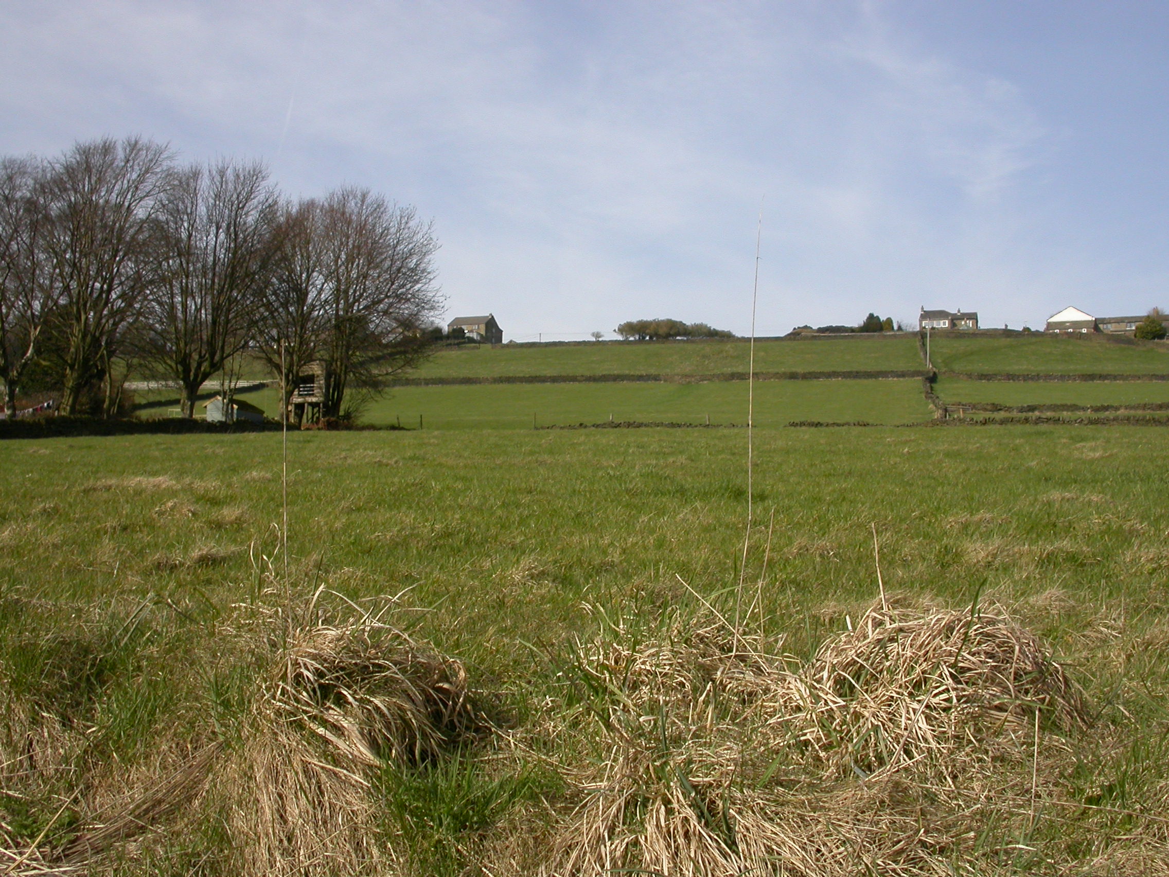
- TH/013 Spring Holes Lane. Land to the south-west of Spring Holes Lane from the junction with Wicken Lane, up to the boundary of 1 Spring Holes Lane, and to the south west adjoining the Wicken, Thornton Recreation Ground, and part of the north-eastern boundary of the Cricket field land. Possible 60.5 dwellings. The photo is of part of the first field where the horses graze. ** This site is no longer in the 2021 Thornton Area Local Plan’s suggested sites (Updated 8 March 2021)

- TH/020 Spring Holes Lane, north-east side, first field from boundary of Cote Gap Farm. Possible 17.5 dwellings ** This site is no longer in the 2021 Thornton Area Local Plan’s suggested sites (Updated 8 March 2021)
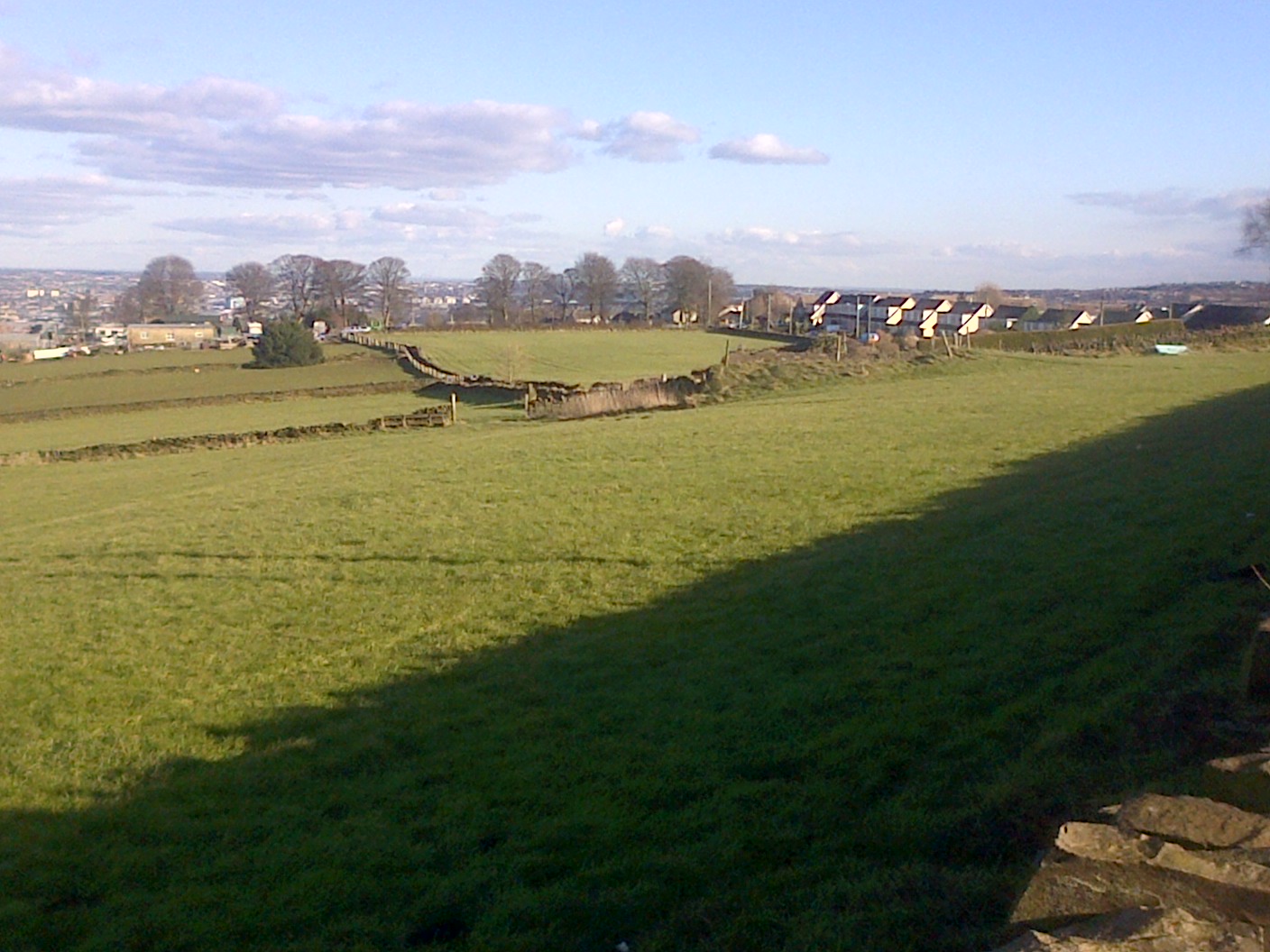
- TH/014 and TH/028, which are joined. The sites cover 3 fields north of Back Lane, from Cote Gap Farm to opposite Leaside Drive, apart from the 2nd field back to the east of the public footpath to Allerton Upper Green. Total 4.07 hectares, approx 120 dwellings. The 2nd field back can be seen in the photo above, showing TH/020. It starts on the left of the ph0to, about half way up that side, and leads to another walled footpath going off to the left. We suspect it’s not included due to ownership of individual fields. ** These sites are no longer in the 2021 Thornton Area Local Plan’s suggested sites (Updated 8 March 2021)

- TH/019 Back Lane, Field going north with trees and animal husbandry, and hillocks – site of the former Thornton Isolation Hospital. Possible 38.5 dwellings. ** This site is no longer in the 2021 Thornton Area Local Plan’s suggested sites (Updated 8 March 2021)

- TH/025 Back Lane, north, between TH/019 and Back Lane / Valentine Court junction, going further north than TH/014. Possible 115.5 dwellings ** This site is no longer in the 2021 Thornton Area Local Plan’s suggested sites (Updated 8 March 2021)

- TH/022 Northcliffe Lane. First field northwards bounded by Grandage Gate Farm and Northcliffe Lane. Possible 33.5 dwellings ** This site is no longer in the 2021 Thornton Area Local Plan’s suggested sites (Updated 8 March 2021)

- TH/008 Land at Old Road, opposite School Green, both an existing green field in the Green Belt leading up to but not including the field full of trees, and village greenspace land behind the electricity substation, and houses on Old Road and the east side of Allerton Lane. Possible 54.5 dwellings ** This site is no longer in the 2021 Thornton Area Local Plan’s suggested sites (Updated 8 March 2021)
CONSULTATION
About these possible housing sites Bradford Council asks :
DEVELOPMENT QUESTIONS
- Which of the sites, would be best suited for: Housing, Employment, Community use, Gypsies & Travellers, Travelling Show people, or Retail use?
- Are there any other suitable development sites or locations which are not identified?
- Should any of the sites, be identified for development either early in the Plan period or later?
- Should the need for development be met by allocating fewer large sites or more small sites?
- Should a housing density target be set for this settlement or to part of the settlement?
We have supplied information about potential housing sites in Thornton. We have been reluctant to give you views on which sites are the best ones, because we haven’t met to discuss our views. What we would say is that if we had a local council, like Wilsden, Harden, or Sandy Lane we could have held public meetings and listened to all opinions.
However we’ve been asked to give some guidance on what you could comment on, and that is here. It gives alternatives of where the 700 dwellings could be, and the difficulties with some sites. It’s no good saying we haven’t school places, you can’t get a doctor’s appointment, or you shouldn’t build on Green Belt. The developers will pay for improvements, and there isn’t enough land that’s not in the Green Belt for 700 houses. It is just a few ideas. You may have different ones. We urge you to send your comments to Bradford Council, either on-line , on the consultation forms, or other means.
Existing Greenspaces: Bradford Council is also consulting about existing green spaces. These can be seen on the 2 following Word documents:
greenspaces doc greenspaces docx
Thornton’s green spaces are:
- Thornton Cemetery
- A swathe of land either side of the Brontë Way leading from the central third of the cemetery towards the footpath which goes from Wensley Bank West to join the Brontë Way. Part of possible housing land TH/003 crosses this land.
- The Cricket ground, Thornton Rec., and The Wicken
- Thornton Primary School playing fields
- The Bowling Green and the Multi-Use Games Area leading off Wensley Bank West, and the current allotments, the sloping small football kickaround area, and the children’s play area off Royd Street
- A small patch of ground east of Havelock Square and south of Havelock Street.
- Open space between Havelock Street and Sapgate Lane
- A much larger green sloping green field, but not as bad as Royd Street, with goalposts, School Green.
- Part of potential housing site TH/008 adjoining and round the back of houses on Allerton Lane and Back Lane, fronting on to Back Lane
- Thornton Grammar School playing fields.
The questions asked by Bradford Council are:
- “Do you think the areas currently protected as greenspace should retain their greenspace designation?
- Which of the areas have special significance and are most important?
- Are there any other areas not shown on the map which should also be protected?”
You will note that part one area of green-space, east of the cemetery is part of proposed housing site TH/003. So it’s a question of should it remain green-space (either side of the Brontë Way), or be a housing site.
Employment sites The consultation document states:
“The Core strategy proposes the allocation of strategic employment zones in the District. These are zones which can encompass a number of new development sites along with established industrial or commercial operations and within which, only employment related developments are permitted.
There are currently no employment zones designated within Thornton but
current employment clusters may provide the opportunity for their introduction.”
- EMPLOYMENT QUESTIONS
Is there any potential in this settlement for further employment zones to be defined?
Quoted from Bradford Council’s website:
“Next steps
Following this consultation, Bradford Council will analyse the comments submitted and then undertake further analysis of the potential options in each settlement. This will involve detailed site appraisal, a green belt review, a review of infrastructure and sustainability appraisal work before a preliminary draft plan is published for comment.
For further information please contact Planning.Policy@bradford.gov.uk with your query and we will get back to you as soon as possible. Alternatively phone 01274 433679.”
A note from Thornton Community Partnership: We hope you find our site useful. We apologise for any typographical errors. We are volunteers and give freely of our time. If you want us to add anything to our site, e.g. specific events, businesses, clubs and organisations, etc, or correct anything, email us the details at aaboutthornton@gmail.com
( updated July 27, 2017 – updates the status of the Core Strategy and a link to the Council’s latest information on the local allocations – see Plan-It newsletter link on this page. )
(Updated 8 March 2021 to show which sites are no longer included in the Thornton area local plan)
